Oxford Peak, ID
““Oh, I’ve got the whole weekend to myself. Time to see what I’m made of. What can I do in two days . . . 3 peaks? 4 peaks? How about 4 peaks, and 3 of them over 2,000’ of prominence. Oh yeah, this is going to be NUTS!””
The above quote is all too familiar. Lots of big dreams. Then reality hits. I get out of town late. I don't sleep well or I'm too lazy to get up to my alarm. In the case of a trip to Southeast Idaho last spring, it was all of those things, plus a snowdrift that added 2 hours to my drive and cut me off from my first peak. So in the end, I settled for just one peak. But it was a good one:
Oxford Peak, ID
route - North SLopes
Vital Stats - E/9,300' - P/4,030' - L:10mi - V: 4,000'
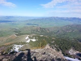
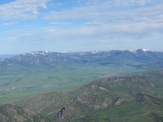
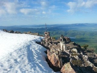
Oxford Peak is one of the biggest of the basin and range peaks that dominate the southeast corner of my state. 4,030' of prominence is the 10th most in the state, making Oxford elite among Idaho's big mountains. One look from the top, or from the town of Malad below, and that status becomes immediately clear.
I made it to the Caribou National Forest Friday evening and camped in a field adjacent to Cherry Creek trailhead - yes, this mountain has an actual trailhead. I had planned to do a simple out-and-back hike up Tr. 407, Tr. 409 and the NE ridge However, surprisingly high water from spring runoff had flooded the trail up the Middle Fork of Cherry Creek. I wasn't keen on soaking my feet that early in the morning (5:00am-ish) so I headed up the Left Fork instead, turning my out-and-back in to a 10-mile loop
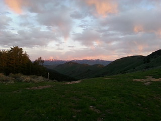
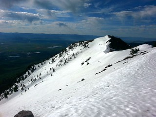
It worked out fine though. The 4x4 track up the gulley was easy hiking and I reached the ridge in time for a fine sunrise view of Oxford - see the photo above. The trail was never hard to follow until it was covered by snow at around 8,400'. Lucky for me the snow was still firm and the going easy up the ridge to the summit. The weather was fantastic, the view clear and expansive. I haven't been to this part of Idaho often, but I can only imagine some of it's prettiest moments are in the spring:
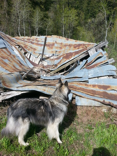
After some time on the summit, we went back the way we came. However, when the trail left the ridge and went north, we went west and stayed on the ridge. I was looking to intersect Tr. 409 but found no sign of it on the ridge. Instead I just went generally down the valley until finding the old structure shown on the map in Mine Creek. It looked like the remains of a mining camp, and had the most dilapidated picnic table I'd ever seen. From there it was an easy hike up and over Tr. 408 and 420 back to my car.
I debated heading over to Pebble Creek to attempt Bonneville Peak as well. However, with the extra mileage it was getting late and I still had to get home. So I packed up and drove the 4 hours back to Boise.