Winter hike to Smith Creek Falls
A short hike to a well hidden frozen wonder
One of my favorite type of hikes is the "Natural Phenomenon" hike. A hike that allows you to witness something that transcends the already-spectacular beauty of the outdoors and gives you a once-a-season or even once-a-lifetime experience. One well known example of this type of hike is Old Faithful in Yellowstone National Park. A lesser known but equally awesome phenomenon is the Frazil Ice of Yosemite Valley. I've been on a few hikes that could fit this category: a midnight hike on a 13,000'+ ridge during a meteor shower, or running into a Bighorn Sheep herd during the rut. Most recent, though, was my hike last weekend to Smith Creek Falls, organized by Mike Allen of the Idaho Outdoors Yahoo Group. This definitely qualifies:

Smith Creek Falls in winter.
After a long and beautiful drive from Boise (which included a moose sighting) to the South Fork Boise River Canyon, we pulled to the side of the road near where Smith Creek meets the Boise River. Spend one minute in this area and you know that the river goes hand in hand with the cliffs on either side of it. So any tributary that dares join the mighty Boise must descend one of these cliffs--making for quite a few waterfalls (note to self--come back during peak flow season!).

An unnamed waterfall pours into frozen Arrowrock Reservoir.

The falls viewed from the top of the canyon.
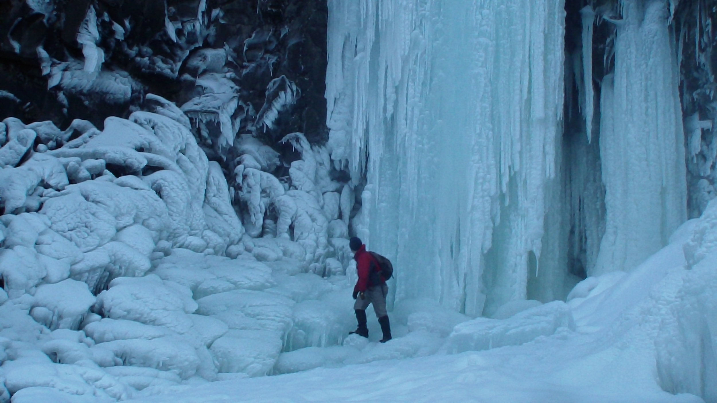
The season, though, along with the numbing cold temperatures we've had the last few weeks, has made Smith Creek Falls an entirely different animal. A steep descent of a nearby slope brought us into an icy wonderland that only comes around during the coldest part of the year.
WARNING: This hike is short but potentially VERY dangerous. Slippery rocks, tall cliffs, thin ice and cold, fast moving water, and a steep descent all add up to potential for accidents. I recommend going with someone who has already been to the falls and knows what gear is required to be safe.
Directions: Take exit 64 of of I-84 and turn left onto Blacks Creek Road. Start your odometer here. In 6.3 miles, turn left again to continue on Blacks Creek Road. The road will take you up and over the summit (which can be icy in the winter--bring a 4WD vehicle) and eventually down to the Boise River where it meets Arrowrock Reservoir. At about 28 miles, the road turns back off of the main canyon and into Smith Creek Canyon. Park on the shoulder and walk just a few hundred feet to the cliff for a view down into the canyon. A half-mile further down is a good place to park and cross the frozen smiths creek (don't cross if the ice seems unstable).
After crossing the creek you will hike west across a field and shortly meet up with a forest service road. The road will enter the forest, and a steep hill on the right is the best place to descend to the creek below. Our group set up a handline to assist in the descent and I HIGHLY recommend this. Bring a 300-ft rope. At the bottom, simply follow the creek up to the falls. Again, be cautious on the frozen creek. There were spots where it was clearly thin ice, and some places where there was no ice at all. Stay to the sides and on rocks and logs where you can. The falls are just around the corner. One can carefully walk around the ice on the right side of the falls for a spectacular photo op surrounded by the ice. Return to the road via the way you came.

A steep, snowy descent is best negotiated with the aid of a hand line.
Everything was frozen.

The group gathered for photos at the base of the falls.

A bush near the top of the falls, frozen white.